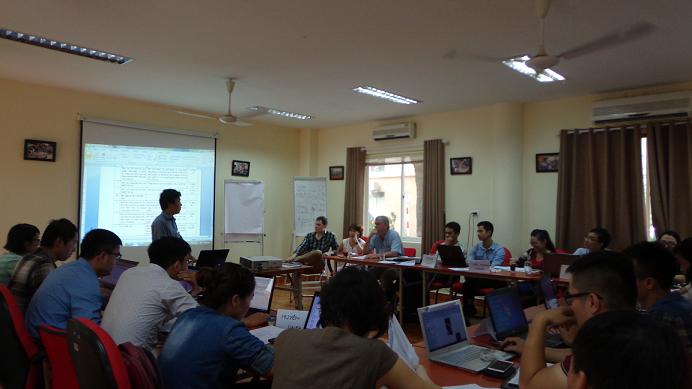
MoU on cooperation between the IWRP and Winrock International through the USAID-funded Vietnam Forests and Deltas Project
On 10th November 2015, the Institute of Water Resources Planning and Winrock International, through USAID-funded Vietnam Forests and Deltas Projects has signed a Memorandum of Understanding (MoU) .
VFD and IWRP are shared the visions and interests in both programs conducted by VFD and IWRP and there is strong potential for synergy and complementary support to natural water management institutions, provincial leaders, and water management agencies of the Ca River and Red River basins.
The overall goal of this MoU between the USAID-funded VFD Project, and IWRP is to provide a framework for both parties to collaborate in water resources development and management at river basin scale. This MoU articulates partnership principles and possible arrears for future cooperation. VFD and IWRP agree to:
- Pursue collaboration in related studies in Red River Basin and Ca River Basin in the areas of: (i) water resources management; (ii) climate change adaptation; (iii) sustainable development; (iv) disaster prevention; (v) remote sensing and information technology.
- Ensure the exchange of relevant data information in above areas.
- Exchange expertise and technical staff in above areas.
- Winrock International, through the USAID-funded VFD Project intends to support IWRP through providing training, capacity building and technological transfer.
- Co-organize and co-host forums, workshops and sessions related to the areas of interest.
- Co-organize training and capacity building for provincial water practitioners in Ca River Basin.
- Participate in a joint planning session that producers and action plan for the initial implementation period of one year.
- Hold monthly meeting to discuss progress, extend communications and subsequent planning.
- Identify focal point person to coordinate the implementation of this MoU from both sides.
VFD is being implementing by Government of Vietnam MARD and provincial governments, and other partners including SNV, SRD since 2012. The Program was initiated to support climate change resilience planning and action from community to national level. It will support four provinces including Thanh Hoa, Nghe An, Nam Dinh, Long An in addressing long term, climate change risks and vulnerabilities in both upland forest and delta landscapes. The VFD program has provided ongoing supports to the Nghe An province in developing a water accounting plus (WA+) framework in Ca river basin that assesses the availability and consumption of available water resources, using remote sensing data freely available on the internet, to serve for effective water resources management and strategic planning in the long term.
IWRP is a part of MARD. IWRP’s formal function is to advise MARD, the Directorate of Water Resources and local provinces in formulating water resources planning, regulating water use in river basins as well as protecting and developing water resources and the environment in a sustainable way in order to help facilitate socio-economic development. IWRP is working in a number of initiatives that promote the use of modern earth observation technology, i.e. remote sensing and GIS database to improve the efficiency of water resources management in Red River and Ca River Basin. IWRP will begin the implementation of the research project named “Study and calculation of runoffs to facilitate the management and utilization of water resources within the Ca river basin, applying mathematical models and remote sensing technology” funded by MOST in late 2015. The project aims to applying mathematical models and remote sensing technologies in run off calculation and water demand, to serve water resources management and utilization in Ca river basin.

- IWRP and IHI (Japan) discuss cooperation opportunities in water resource management and disaster prevention
- Sustainable Water Management - Participatory Cooperation Framework Towards Managing Water-Related Risks
- Join us in creating a participatory cooperation framework to effectively manage water – related risks!
- Building Climate Resilience: Tailored Training on Embracing Nature-Based Solutions in Vietnam, Sponsored by Nuffic.
- The technical exchange seminar discussed the scientific and technological task outlined in the memorandum between Japan, Indonesia, and Vietnam titled "Development of machine learning and remote sensing-based water management platform for sustainable agri
- Invitation to Participate in the e-Asia Project Workshop: Advancing Water Management Platforms in Asian Deltas
- Young Professionals for Sustainable Water Resources Forum 2023 (YP4W Forum 2023)
- IWRP met experts of the FAO Water Scarcity Program (WSP) for Asia-Pacific
- YP4W FORUM 2023 - CALL FOR REGISTRATION
- MOU signed between the IWRP and the Russian State Hydrometeorological University (RSHU)
- Meeting with the Regional Director of Erhard Muhr GmbH (Germany)
- The Training Program "Eco-Hydrology in Integrated Water Resources Management in Adapting to Climate Change" opened
- First Secretary of the Embassy of Japan in Vietnam meets the IWRP’s leaders on the occasion of ending his working term
- IWRP delegation paid a working visit to the International Environment Management Co. Ltd in Bangkok, Thailand
- e-ASIA Joint Research Program Workshop on “Intelligent Infrastructure for Water” held at the IWRP Office on February 21-22, 2019


