Achievements
1. Investigations, planning and feasibility studies:
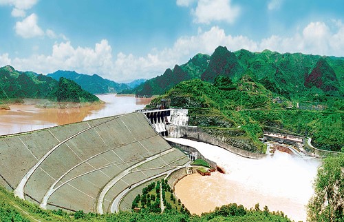
Since 1961: The Institute has investigated and formulated plans for training and exploitation of the Red River. This includes the following five planning aspects; flood control, water supply, drainage, navigation and mapping of the main cascades in the Red River. The institute proposed many of the completed large-scale hydraulic structures in the cascade diagrams (including Hoa Binh, then Thac Ba and Tuyen Quang reservoirs) and on-going structures including the Son La project.
1975 - 1994: In the South, four planning teams of the Institute carried out investigation and planning in areas including the Central Region and Central Highlands, Southeast Region and Cuu Long River Delta. The planning and construction projects for these regions were quickly completed. As a result, many of the finished structures have played an important role in Vietnam’s economy. These include the reservoirs of Dau Tieng, Tri An, Phu Ninh, and Thac Mo, and canals for fresh water diversion and soil reclamation such as Hong Ngu and Quan Lo - Phung Hiep.
1995 - 2008: 30 to 40 domestic and international water resource planning projects have been investigated every year. This includes a number of feasibility studies and projects of significant importance for regional development such as the Hong Ngu canal (Plains of Reeds), and the system of KH canals in the west of the Hau river.
2009 up to now: Water resources Master planning in context of climate change and sea level rise for the Red River Delta and the Northern Central area in period from 2012 to 2020 and a vision to 2030 (approved by the Primer Minister in 2013); Integrated water resources planning for the Hong – Thai Binh river delta; Water resources planning for the key economical developing areas in Northern area, Central and Highland Central area… Water resources, water supply and flood control planning for the river basins, such as Lo Gam, Da – Thao, Ma, Tra Bong – Tra Khuc… and economical areas such as Ha Noi capital area, Hung Yen province, Dak Nong province, Thanh Hoa province, etc.
Preparation or finalization of water resource plans for various river basins:
- Water resources Master planning for the Highland Central Area in context of climate change (2012-2014)
- Review of water resources planning for the Cau and Thuong river basins (2012-2014)
- Review of water resources planning for the Ma river basin (2012-2014)
- Planning of flood control for the area of Ha noi capital (2012-2014)
- Water resources planning for Ninh Binh province (2012-2013)
- Water resources master planning for Thanh Hoa province in period from 2020 to 2030 (2011-2012)
- Review of water resources planning for the Ca river basin (2011-2012)
- Water resources planning in context of climate change from 2011 to 2015 and a vision to 2020 in the Dak Nong province (2011-2012)
- Water resources master planning in context of climate change and sea level rise for the Red River Basin (2009-2011)
- Water resources master planning in context of climate change and sea level rise for the North Central Area (2009-2011)
- Flood control planning for the Red River Delta and downstream reaches of the Thai Binh River (1995 - 2000)
- Flood control planning for the Cuu Long River Delta (1996 - 1999)
- Master plan for water resources development in the Dong Nai River (1995 - 1996)
- Integrated water resources planning for Ca River basin (2001-2004)
- Water Resources Review for 9 River basins, including Bang Giang, Ky Cung, Vu Gia, Thu Bon, Ca, Ma, Nghen, Ba, Sesan and Srepok;
- Orientations for flood control planning in the Central Region from Thanh Hoa to Binh Thuan provinces during 1995 - 2000;
- Integrated Da River basin water resources use plan;
- Integrated Red - Thai Binh River basin water resources use plan;
- Designs for detailed water resource plans for river basins including Cau, Thuong, Day, Chau, Tich and Ngu Huyen Khe in the North Delta; and Nghen, Hoat, Chu, Gianh, Nhat Le, Ben Hai, Vinh Phuoc, and Cai rivers in Nha Trang in the Central region;
- Review flood control plans for Central provinces including river basins from Quang Binh province to Binh Thuan province;
- Integrated Ma River basin water use and protection planning;
- Water resources development strategies and integrated plans for the river basins in Thua Thien Hue province.
Preparation of planning designs for economic regions and provinces:
- The Institute has been preparing detailed water resources planning designs for the following areas and provinces: Ha Noi, Bac Kan, Lai Chau, Lang Son, Gia Lai, Dak Lak, East Hau river, Dong Thap, Tien Giang, An Giang, Hau Giang, the area between East Vam Co and West Vam Co Rivers and neighboring areas, Plains of Reeds, the industrial triangle along the Road No.18, the industrial triangle of Ho Chi Minh - Bien Hoa - Ba Ria and south Nguyen Van Tiep area;
- Water resources plans for the key economic zone in the Central Region;
- IWRP is also involved in water balance calculations and the formulation of water supply plans for industrial zones and residential areas in Tinh Gia (Thanh Hoa); water balance calculations for the Cuu Long River Delta as part of the water resources development strategy of the Mekong River Basin; water balance calculations for the Central Region; water supply planning for Ha Long city; industrial zones of North Hanoi; and flood control planning for the Huong River and Hue city;
- Water resources plan for the North Coastal areas;
- Water resources plan for Tuyen Quang province for the period 2007-1015;
- Review of the national water resources plan.
Study on impacts of water quality, environment and climate change: All planning projects include a study of the potential impacts of structures on the ecosystems and the environment in which they are located. Impacts are identified and solutions to protect water and ecological resources are then formulated. In addition a study on the Red River environmental flows requirements was completed.
2. Baseline investigations:
Baseline investigations constitute one of the regular tasks of the Institute. The Institute is in fact maintaining a rich database on water resource development in every river basin. In addition, other data and information on hydrometeorology, topography, geology, water quality, etc. are maintained by the Institute.
Main baseline investigations have been carried out by the Institute:
- Annual monitoring and assessment of the Red River water quality for the Winter-Spring crop cultivation.
- Arsenic investigation in the coastal area of the Red river plain.
- Annual monitoring and assessment of water quality in the Nhue irrigation and Drainage system.
- Minimum flow measurement of the small rivers in the Central area.
- Minimum flow measurement of the small rivers in the Northern mountainous area
- Water quality monitoring of the Se san – Srepok river before flowing into Cambodia.
- Assessing the impacts of climate chane and sea level rise on the water uses in the coastal area from North, Northern Central and Southern Central areas.
3. Preparation of the National Water Resources Development Strategy
The Institute provides advice to the Government and the Ministry of Agriculture and Rural Development on integrated development alternatives for the Son La hydropower project in relation to the flood control plan and the water resource use plan.
The Institute prepares and implements baseline investigation projects, sets up specialized water quality monitoring points, and provides data for modelling the variation in water quality in river basins in order to assess the environment impacts of water resource development projects.
The Institute is the key counterpart agency in international cooperation projects on water resource development.
The Institute prepares the Water Resources Strategy to 2030 and vision to 2050.
4. Scientific and technology studies:
National-level studies:
- The Study on establishing the operation rule of Son La, Hoa Binh, Thac Ba and Tuyen Quang reservoirs in the dry season. A national-level independent research, 2011-2013.
- KC08.07/11-15: The study on evaluating the impacts of hydraulic structures, hydropower plants, transport system and infrastructure on flooded situation in Central and proposing effective and feasible solutions to prevent and mitigate. Program KC08/11-15: National key program on Scientific research and technology for disaster prevention, environmental protection and rational use of natural resources (2012-2014).
- KC08.24/11-15: The study on assessement of existing and potential uses of the surface water in the Southern Central area to calculate water resources balance and to propose the solutions for improving of the efficient and sustainability of water use. Program KC08/11-15: National key program on Scientific research and technology for disaster prevention, environmental protection and rational use of natural resources (2012-2014).
- KC08-14: Research on flood forecasting, identification and control in the Mekong Delta to allow for socio-economic development (2001 - 2005);
- KC12 (1991 - 1995): nationwide water balance and protection and efficient use of water resources;
- Program 06-03 (1981 - 1985), 06-02 (1985 - 1991) baseline investigation;
- Study on saline intrusion in the Cuu Long River Delta;
- Study on global climate change;
- Impact assessment of Hoa Binh Reservoir on downstream users;
- Appraisal of the selection of cascade options and capacity of the Son La hydropower plant.
State and Ministerial-level Studies:
- Proposal of plan and improvement solutions for adaption to climate change of hydraulic work systems in the Red River Delta Coast
- Study into scientific and practical basis to propose operating rules for multipurpose inter-reservoirs on Vu Gia-Thu Bon Rivers for the purpose of preventing and retarding floods and reservoir operation safety;
- Study into structural measures for water storage and supply for domestic use in water shortage areas in 8 provinces in the North Mountains;
- Research into scientific basis and technological solutions for sustainable development of the Red River basin (2006);
- Development of cascade reservoir operation procedures on Da and Lo Rivers in order to regulate dry season flows for Red - Thai Binh River downstream (2006);
- Proposal of advanced and suitable water resource planning procedures and technologies to support sustainable socio-economic development in Northern Midlands and Mountains (2004 - 2006);
- Application of the hydrodynamic model MIKE SHE to ensure rational use of the Srepok River basin surface and ground water resources (2004 - 2006);
- Application of GAMS to optimizing operation management of hydraulic works systems in the upper Thai Binh basin (2004 - 2005);
- Development of standards and norms for construction of natural disaster prevention and control infrastructure (2004 - 2005);
- Development of the strategy for sustainable management of Vu Gia - Thu Bon River basin natural resources and environment (2002 - 2005);
- Wetland and flood drainage in the Cuu Long River Delta (06A.03.05);
- Scientific basis for flood drainage capacity of hydraulic structures in the Day River Basin (1996 - 1998);
- Improvement of water balance methodologies for water resources and development planning (1998 - 2000);
- Flood analysis methodology and improvement of the optimal operation procedures for the Hoa Binh Reservoir. This study was recommended for Viet Nam’s National Prize by the Awarding Panel;
- Formulation of and improvements to the application of hydraulic models in order to better serve the design of water resource development and management projects in Vietnam;
5. International Cooperation
- Assistance to PDR of Laos in the formulation of water resources development plans for 7 key delta regions, including Vientiane, Bolykhamxay, Savanakhet, Kham Muon, Salavan, Champasac, and Attapu;
- Effective cooperation with international organizations including WB, ADB, SIDA (Sweden), JICA, NIPPON KOEI (Japan), DANIDA (Denmark), and MDBC (Australia) in implementing water resources development projects;
- Member of the Network of Asian River Basin Organizations (NARBO)
- Promoting and expanding cooperation with the Politecnico di Milano (Italy) in training staff and the study on how to adapt the Red-Thai Binh River basin to climate change;
- Cooperating with the International Water Management Institute and the Challenge Program on Water and Food in reservoir management and development;
- Collaborating with and implementing training courses funded by World Bank (WB).
- Joining in the Network for Sustainable Hydropower Development in the Mekong countries as a key partner in researching and training
- Cooperating with the Japan Aerospace Exploration Agency in natural disaster mitigation;
- Participating in the Capacity Building to Water Institutes Project by DANIDA.